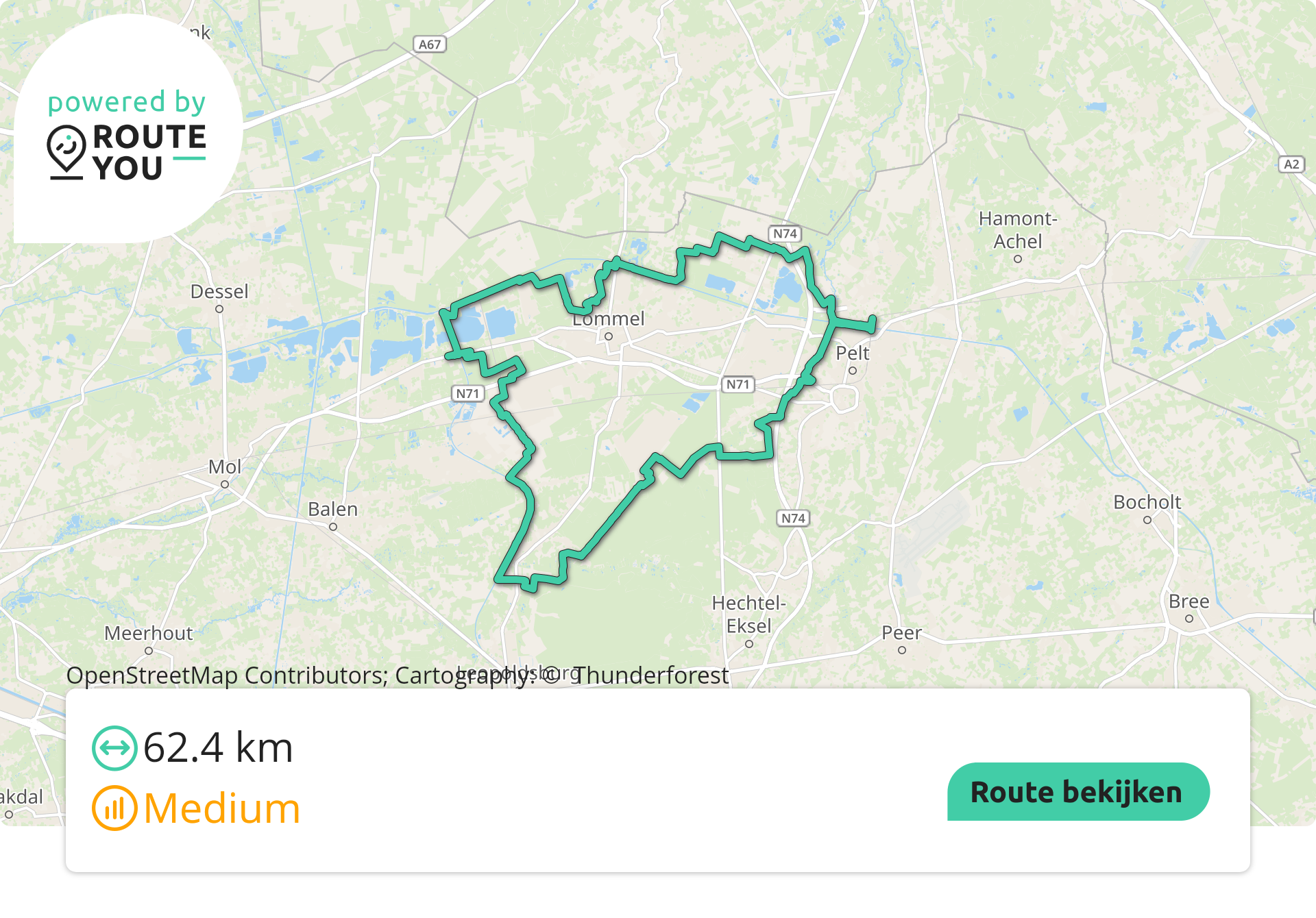
About the standard route (62.3 km)
Follow these cycling nodes: 224 - 260 - 267 - 267 - 553 - 552 - 266 - 275 - 272 - 255 - 254 - 253 - 241 - 220 - 221 - 222 - 225 - 226 - 227 - 230 - 224
- Type of route: cycling route
- Distance: 62,3km
- Elevation: 0m
- Difficulty level: easy
- Start and finish: Parking Soeverein
- Downloads: PDF file2.9 Mb(pdf) - GPX file17.9 Kb(gpx)
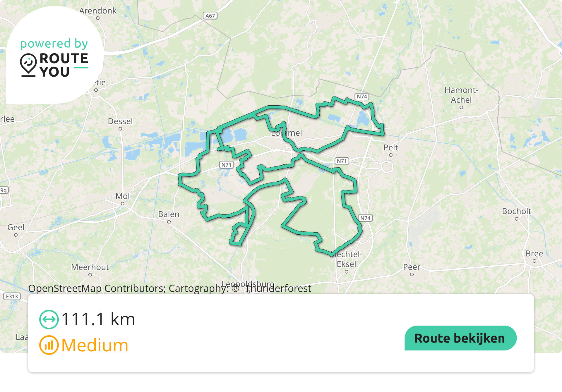
About the extra-long route (111 km)
Follow these cycling nodes: 224 - 260 - 267 - 267 - 553 - 265 - 229 - 253 - 254 - 256 - 257 - 272 - 255 - 264 - 552 - 266 - 275 - 30 - 60 - 59 - 58 - 61 - 10 - 260 - 232 - 231 - 230 - 227 - 226 - 225 - 222 - 221 - 228 - 229 - 224
- Type of route: cycling route
- Distance: 111km
- Elevation: 132m
- Difficulty level: medium
- Start and finish: Parking Soeverein
- Downloads: PDF file (XL)4.3 Mb(pdf) - GPX file (XL)30 Kb(gpx)
Tip! Would you rather plan your own cycling route or expand this one? Use the Bike nodes route planner!